
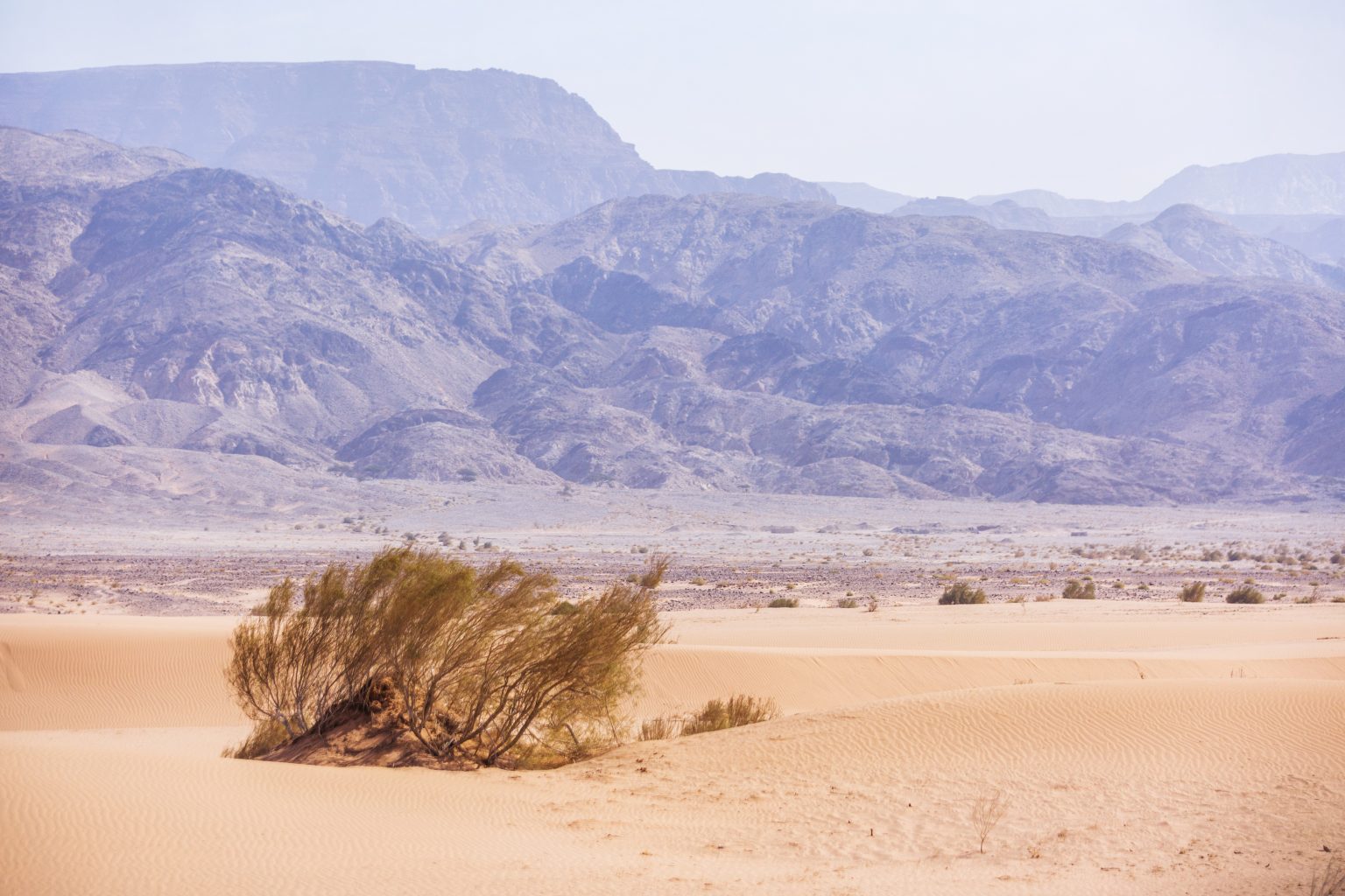
Stretching from the Dead Sea in the north to the Gulf of Aqaba in the south, Wadi Araba is one of Jordan’s largest and most varied desert regions. This long valley combines gravel plains, dry wadis, mountains, salt-rich areas, and scattered vegetation, while its location along the Jordan Rift Valley has shaped both its geology and human history.
- Where Is Wadi Araba Located
- A Landscape of Color and Contrast
- Climate: Hot Summers and Cooler Winters
- Vegetation: Life Adapted to Arid Conditions
- Wildlife of Wadi Araba
- Culture and History in the Desert
- Top Things to Do in Wadi Araba
- Explore Dana and Feynan
- Visit Petra and the Edom Mountains
- Camel and 4WD Safaris
- Stay at Feynan Ecolodge
- Camping and Stargazing
- 2-Day Wadi Araba Itinerary
- Where to Stay
- Helpful Travel Tips
- Hidden Gems of Wadi Araba
- A Desert Corridor Between the Dead Sea and Aqaba
The valley extends for more than 170 kilometers and forms part of the wider Great Rift Valley system. Its landscape has also been crossed by people for thousands of years, including communities associated with Edom, the Nabataeans, and later Bedouin groups.
For travelers, Wadi Araba offers a combination of desert geology, wildlife, archaeological sites, Bedouin heritage, and access to places such as Feynan, Petra, Ghor Safi, and Aqaba.
Where Is Wadi Araba Located
Wadi Araba extends south from the Dead Sea through southwestern Jordan before reaching the Gulf of Aqaba.
Natural Boundaries
- North: Southern Dead Sea
- South: Gulf of Aqaba
- East: Edom Mountains and the Petra region
- West: Negev Desert and the Arava Valley
Main Access Points
- Aqaba in the south
- Petra and Wadi Musa to the east
- Feynan in the northern part of the valley
- Ghor Safi near the southern Dead Sea
The valley contains major changes in elevation and terrain. Areas near the Dead Sea lie well below sea level, while the landscape rises toward the mountains and the southern approach to Aqaba. This variation contributes to the region’s changing vegetation, climate, and geology.
A Landscape of Color and Contrast
Wadi Araba contains several distinct landscape types within a relatively narrow north-south corridor.
The Rift Valley Floor
The valley floor consists largely of broad gravel plains, dry riverbeds, alluvial deposits, and areas of sandy or rocky terrain. Long stretches have very little development, creating wide views across the surrounding mountains.
The Edom Mountains
To the east, the Edom Mountains rise above the valley. Their sandstone and rocky slopes share geological characteristics with the landscapes around Petra, with strong red, orange, and brown tones visible in many areas.
Salt Flats and Sabkhas
Near the Dead Sea, evaporation has created areas with high concentrations of salts and minerals. These surfaces can appear white and reflective under strong sunlight, particularly after seasonal changes in moisture.
Southern Desert Landscapes
Toward Aqaba, the valley becomes increasingly rocky and arid, with sandy areas and exposed mountains surrounding the southern end of the rift.
The result is a region where geological conditions change significantly along the route from the Dead Sea to Aqaba.
Climate: Hot Summers and Cooler Winters
Wadi Araba has a hot desert climate, although temperatures vary with elevation and location.
Typical conditions include:
- Low annual rainfall, often around 50 to 100 mm in the driest areas.
- Very hot summers, with temperatures that can exceed 40°C.
- Cooler winters, particularly at night.
- Short periods of vegetation growth following seasonal rainfall.
The most comfortable period for many outdoor activities is generally October to April. Spring rainfall can temporarily bring new grasses and other vegetation to parts of the valley before the landscape returns to its predominantly dry conditions.
Travelers should still expect strong sun during the cooler months and prepare for significant temperature changes between daytime and nighttime.
Vegetation: Life Adapted to Arid Conditions
Vegetation is sparse across much of Wadi Araba but becomes more noticeable around wadis, springs, agricultural areas, and locations with access to groundwater.
Common plants and habitats include:
- Acacia trees, important sources of shade and food for wildlife.
- Tamarisk, particularly in areas with saline or periodically wet soils.
- Salt-tolerant shrubs, including various saltbush species.
- Seasonal grasses, which appear after sufficient rainfall.
- Palm groves, particularly around irrigated areas such as Feynan and Ghor Safi.
These plants play an important role in supporting wildlife and traditional human activities in the valley.
Wildlife of Wadi Araba
Although much of Wadi Araba appears dry and sparsely vegetated, its varied habitats support a range of desert species.
Mammals
- Arabian oryx occur in protected areas and conservation programs in the wider region.
- Gazelles inhabit suitable desert and rocky environments.
- Red foxes and other small carnivores are adapted to the arid landscape.
- Rock hyraxes occur around rocky mountain habitats.
- Camels remain important in some Bedouin communities and desert tourism activities.
Birdlife
Wadi Araba forms part of the broader Rift Valley migration corridor, making the region important for migratory birds.
Depending on the season, visitors may encounter:
- Hoopoes
- Falcons
- Eagles
- Migratory raptors
- Other desert and mountain bird species
Reptiles
The valley also supports numerous reptiles adapted to high temperatures and limited water, including lizards, agamas, and desert snakes.
Wildlife is generally easier to observe in protected areas, wadis, and locations with vegetation or water.
Culture and History in the Desert
Ancient Trade Routes
Wadi Araba has been part of important movement and trade networks for thousands of years. The wider region was connected to routes used by the Nabataeans and other ancient communities moving goods between Arabia and the Mediterranean.
The valley’s position between the Dead Sea and Aqaba also made it an important geographic corridor between the interior and the Red Sea.
Bedouin Heritage
Several Bedouin communities have longstanding connections with the region. The Howeitat are among the groups historically associated with southern Jordan.
Traditional activities have included herding, seasonal movement, trade, and the use of desert plants and water sources. Hospitality remains an important part of local culture, with tea, bread, and shared meals commonly offered to guests.
Modern Sustainability
The Feynan area has become an important example of desert tourism and conservation. Eco-tourism projects provide visitors with opportunities to explore the landscape while supporting local employment and community-based tourism.
Top Things to Do in Wadi Araba
Explore Dana and Feynan
The transition from the higher landscapes of the Dana region toward the arid terrain around Feynan provides one of Jordan’s most interesting ecological changes.
Hiking routes can pass through several vegetation zones before reaching the dry valley floor.
Visit Petra and the Edom Mountains
Wadi Araba can be combined with a visit to Petra, allowing travelers to experience the area’s archaeological heritage alongside the surrounding mountain and desert landscapes.
The Edom Mountains provide a geological context for the sandstone formations found around Petra.
Camel and 4WD Safaris
Guided camel trips and 4WD excursions provide access to areas away from the main roads.
Depending on the route, excursions may include:
- Rocky desert plains
- Mountain valleys
- Dunes and sandy areas
- Archaeological sites
- Wildlife observation points
Stay at Feynan Ecolodge
A stay around Feynan provides access to hiking routes, archaeological remains, Bedouin cultural experiences, and desert landscapes.
Evening activities may include traditional meals and guided walks focused on the local environment and night sky.
Camping and Stargazing
Remote sections of Wadi Araba offer excellent conditions for stargazing, particularly away from towns and major roads.
Camping should be organized with experienced local guides or according to the regulations of the relevant protected area.
2-Day Wadi Araba Itinerary
Day 1: Feynan and Desert Heritage
- Morning departure from Petra, Dana, or another nearby base.
- Travel toward Feynan and explore the surrounding landscape.
- Visit archaeological areas and historic copper-mining sites where accessible.
- Evening dinner and a Bedouin cultural experience.
Day 2: Desert Landscapes and the Dead Sea Region
- Morning camel or 4WD excursion through selected desert areas.
- Explore rocky plains, wadis, or other accessible landscapes.
- Continue toward Ghor Safi or another destination near the Dead Sea, depending on the route.
- Finish the day with an overnight stay or continue toward Aqaba.
Because Wadi Araba extends across a very large area, travelers should select a specific section rather than trying to cover the entire valley in two days.
Where to Stay
Accommodation ranges from eco-lodges and guesthouses to desert camps.
Eco-Lodges and Guesthouses
Feynan Ecolodge is one of the best-known accommodation options in the region and provides access to hiking, cultural activities, and desert landscapes.
Bedouin Camps
Bedouin-style camps provide a more traditional desert experience, often including local meals, guided excursions, and evening activities.
Wild Camping
Wild camping may be possible in some areas, but travelers should check access restrictions and protected-area regulations before setting up camp.
Helpful Travel Tips
- Best season: October to April is generally the most comfortable period.
- From Petra: Travel times vary according to the destination within Wadi Araba.
- From Amman: Allow several hours, depending on the final destination and road conditions.
- Vehicle: A 4WD is recommended for remote tracks and desert excursions.
- Essentials: Carry sufficient water, sunscreen, a hat, suitable clothing, navigation equipment, and a camera.
- Protected areas: Check whether permits or local arrangements are required before entering restricted zones.
- Weather: Avoid exposed outdoor activities during periods of extreme summer heat.
- Wildlife: Keep a respectful distance from animals and do not feed them.
Hidden Gems of Wadi Araba
Travelers with additional time can explore several lesser-known sites:
- Feynan Copper Mines, associated with ancient mining activity dating back thousands of years.
- Ghor Safi and Zoar, an important historical area near the southern Dead Sea.
- Humeima, an archaeological site associated with Nabataean and later Roman-period settlement.
- Wadi Ghuweir, known for its canyon landscape and vegetation along sections of the route.
Access to some locations can be seasonal or dependent on local conditions, so checking with local guides before departure is advisable.
A Desert Corridor Between the Dead Sea and Aqaba
Wadi Araba is defined by its position between two major bodies of water and by the geological forces that created the Jordan Rift Valley. Along its more than 170-kilometer length, the landscape changes from salt-rich lowlands and broad desert plains to rocky mountains and the southern approach to Aqaba.
The valley also brings together several layers of Jordanian heritage: ancient trade routes, archaeological sites, Bedouin traditions, conservation projects, and modern desert tourism.
For travelers, Wadi Araba is best understood as a geological and cultural corridor, where desert landscapes, wildlife, archaeology, and mountain scenery change progressively between the Dead Sea and the Gulf of Aqaba.