
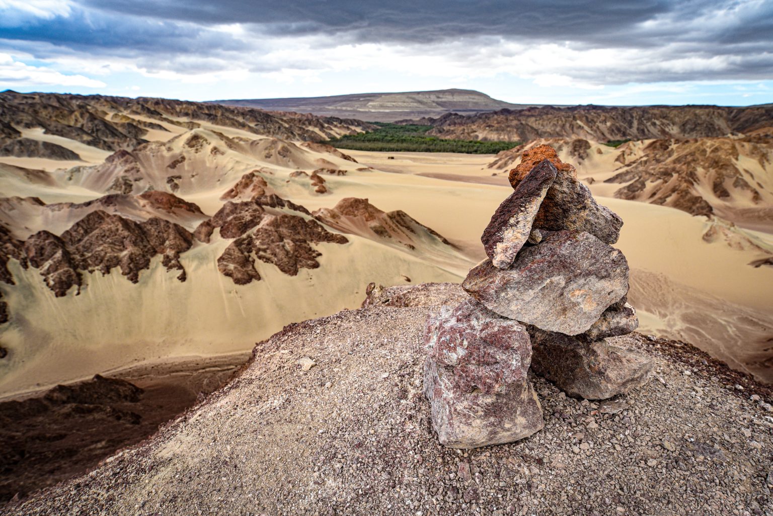
The Nazca Desert is one of the most remarkable archaeological landscapes in South America. Located in southern Peru, it is known for its extremely dry climate and the enormous geoglyphs created across its desert plains more than 2,000 years ago.
- Where Is the Nazca Desert Located?
- A Landscape of Sun, Stone, and Extreme Dryness
- The Mysteries of the Nazca Lines
- Best Time to Visit the Nazca Desert
- Best Things to Do in the Nazca Desert
- More Places to Discover in the Nazca Desert
- 2-Day Nazca Desert Itinerary
- Where to Stay in Nazca
- Cultural and Spiritual Meaning
- Practical Travel Tips
- Hidden Gems Near Nazca
- A Desert Landscape Preserved by Time
Across its ochre-colored landscape lie hundreds of geoglyphs, etched directly into the desert surface across an area of more than 500 square kilometers. Spirals, spiders, hummingbirds, monkeys, and long geometric lines form some of the most recognizable archaeological features in Peru.
The Nazca Desert is particularly important because the region’s exceptionally dry conditions helped preserve these drawings for centuries, allowing researchers to study the landscape and the people who created them.
Where Is the Nazca Desert Located?
The Nazca Desert lies about 450 kilometers south of Lima, within the Ica Region of southern coastal Peru.
Geographic coordinates: 14°50′S, 75°08′W
Elevation: 600–800 meters (2,000–2,600 feet)
It is bordered by:
- North: the Ica Desert and Huacachina
- South: the coastal plains of Arequipa
- East: the foothills of the Andes
- West: the Pacific Ocean
The desert forms part of the Peruvian Coastal Desert, a narrow arid region between the Andes Mountains and the Pacific Ocean.
A Landscape of Sun, Stone, and Extreme Dryness
The Nazca Desert landscape is characterized by dry plains, rocky surfaces, and very limited rainfall.
Much of the desert surface is covered with dark stones containing iron oxides. By removing these stones, ancient communities exposed the lighter-colored ground underneath, creating the lines and figures that remain visible today.
The region’s extremely dry climate, limited vegetation, and low levels of erosion helped preserve the geoglyphs for more than 2,000 years. These conditions make the Nazca Desert an important archaeological landscape as well as a distinctive natural environment.
The Mysteries of the Nazca Lines
The Nazca culture flourished between 500 BCE and 500 CE, developing sophisticated irrigation systems, distinctive pottery, and the famous geoglyphs found across the desert.
Shapes and Figures of the Nazca Lines
- Animals: hummingbirds, monkeys, spiders, dogs, whales, condors
- Human and plant forms: hands, flowers, and the figure commonly known as the “astronaut”
- Geometric designs: trapezoids, spirals, rays, and long straight lines extending across the desert
Theories Behind the Nazca Lines
Researchers have proposed several explanations for the geoglyphs, although their exact purpose remains debated.
- Astronomical interpretations: some lines may have been connected to celestial observations and seasonal events
- Ceremonial pathways: some researchers suggest that certain lines were used during rituals associated with water and fertility
- Religious offerings: the figures may have had connections to beliefs about rain, agriculture, and supernatural forces
- Alien theories: popular modern claims that have no scientific basis
The Nazca Lines remain an important subject of archaeological research, particularly because their original purpose cannot be explained by a single theory with certainty.
Best Time to Visit the Nazca Desert
- April to October: generally clear conditions, suitable for scenic flights and photography
- January to March: warmer temperatures and fewer visitors, while the region remains extremely dry
Because rainfall is very limited, the desert and its geoglyphs can be visited throughout the year.
Best Things to Do in the Nazca Desert
Fly Over the Nazca Lines
A 30–45 minute flight in a small aircraft provides the clearest overall view of the major geoglyphs. Flights depart from Nazca or Pisco and typically follow routes that pass over several of the best-known figures.
Visit the Nazca Viewpoint (Mirador de las Líneas)
A 13-meter observation tower along the Pan-American Highway provides ground-level views of several geoglyphs, including the Hands, Tree, and Lizard figures.
Explore the Palpa Lines
The Palpa Lines include geoglyphs that predate or overlap with the Nazca tradition. Their human-like figures and other designs provide additional evidence of the long history of geoglyph creation along Peru’s southern coast.
More Places to Discover in the Nazca Desert
Cahuachi: The Ceremonial Heart
Cahuachi was a major ceremonial center associated with the Nazca culture. Its adobe structures and pyramids provide evidence of religious activities, gatherings, and the social organization of the ancient community.
Chauchilla Cemetery
An archaeological cemetery where 1,000-year-old mummies and burial remains have been preserved by the extremely dry desert climate.
Cantalloc Aqueducts
These sophisticated irrigation systems include spiral-shaped structures that allowed access to underground water. Several remain visible today and demonstrate the Nazca people’s ability to manage water in an arid environment.
Cerro Blanco Dune
At around 2,078 meters, Cerro Blanco is one of the highest sand dunes in the region and a popular destination for hiking and sandboarding. From the upper slopes, visitors can see extensive views across the surrounding desert.
2-Day Nazca Desert Itinerary
Day 1: Nazca Lines and Archaeology
Morning: Scenic flight over the Nazca Lines
Afternoon: Visit Cahuachi and the Nazca Viewpoint
Evening: Sunset walk across the desert plateau
Day 2: Water, Burials and Dunes
Morning: Explore Chauchilla Cemetery and Cantalloc Aqueducts
Afternoon: Hike Cerro Blanco
Evening: Return to Ica or overnight in Nazca
Where to Stay in Nazca
Nazca Town:
- DM Hoteles Nazca
- Casa Andina Standard
- B Hotel Nazca Lines
Desert Lodges:
- Eco-camps near Cahuachi for a quieter setting and stargazing
Cultural and Spiritual Meaning
For the Nazca people, the desert landscape was closely connected to religious beliefs, agriculture, water, and ceremonial practices. The geoglyphs were part of a wider cultural system that included settlements, temples, irrigation works, pottery, and burial traditions.
Today, Andean traditions honoring Pachamama continue to reflect the long-standing cultural importance of land, agriculture, and the natural environment in the region.
Practical Travel Tips
- No altitude acclimatization is generally needed for Nazca
- Lima to Nazca: around 7–8 hours by road
- Best flight time: 8–10 AM, when conditions are often more favorable
- Eat lightly before a scenic flight
- Bring sun protection and sufficient water
- Never walk on the geoglyphs because foot traffic can cause permanent damage
Hidden Gems Near Nazca
- Pampa de Jumana, with remote geoglyphs
- San Fernando Bay, a coastal desert area known for wildlife
- Achaco Aqueduct, an ancient water-management structure
- Ingenio Valley, a greener area within the surrounding desert region
- Nazca Planetarium, offering information about the night sky and the Nazca Lines
A Desert Landscape Preserved by Time
The Nazca Desert combines extreme aridity with one of the world’s most important archaeological landscapes. Its geoglyphs, ceremonial sites, cemeteries, and ancient irrigation systems provide different perspectives on the Nazca civilization and its relationship with the surrounding environment.
The dry conditions that make the region difficult for modern life also helped preserve its archaeological remains for centuries. For visitors, exploring Nazca means seeing not only the famous lines from above, but also the wider landscape of temples, aqueducts, burial sites, and desert formations that give them historical context.
The Nazca Lines remain one of Peru’s most intriguing archaeological sites, with many questions still being studied by researchers today.