
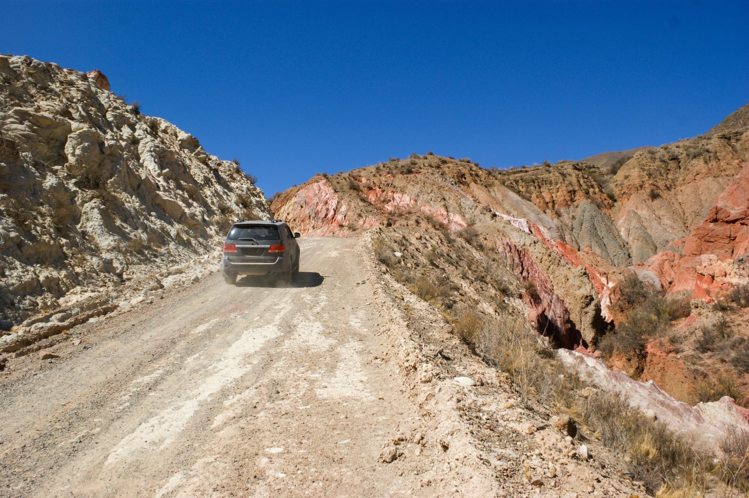
Argentina’s northwestern highlands combine vast salt flats, volcanic formations, colorful lagoons and mountain roads that climb well above 3,000 meters. Traveling by 4×4 in Argentina’s High Andes offers access to remote landscapes, but it also demands careful planning, experience and respect for the conditions.
- Exploring Argentina’s High-Andes Frontier
- The Best 4×4 Routes in Argentina’s High Andes
- 1. Ruta de los Seismiles, Catamarca
- 2. Catamarca to Antofagasta de la Sierra
- 3. Salinas Grandes: From Jujuy into the Puna
- 4. San Antonio de los Cobres to Tolar Grande, Salta
- 5. Quebrada de las Flechas and the Cafayate Region
- 6. Talampaya National Park, La Rioja
- Preparing for a High-Andes 4×4 Expedition
- Essential Vehicle and Navigation Equipment
- Extra Equipment for Remote Terrain
- Tire Pressure and Salt-Flat Driving
- When to Travel in Argentina’s High Andes
- What to Expect on the Road
- Safe and Responsible Off-Road Travel
- A Practical Four-Day High-Andes Itinerary
- Day 1: Arrive in Fiambalá
- Day 2: Explore the Ruta de los Seismiles
- Day 3: Travel Toward Antofagasta de la Sierra
- Day 4: Visit Campo de Piedra Pómez or Continue to Your Next Base
- Discovering the High Andes at a Responsible Pace
Across the Puna plateau, long distances separate small settlements, fuel stops are limited, and weather can change quickly. Some routes follow established mountain roads, while others cross rough tracks that require a suitable vehicle and local guidance. This High Andes travel guide explores the main destinations, practical preparations and safety considerations for planning an off-road journey in northwestern Argentina.
Exploring Argentina’s High-Andes Frontier
Where the High-Andes Desert Is Located
The high-altitude landscapes of northwestern Argentina are concentrated in the provinces of Catamarca, Salta and Jujuy. The wider region includes the Puna plateau, volcanic mountain ranges, salt basins and isolated valleys.
La Rioja, farther south, offers a different desert landscape, including the red sandstone formations of Talampaya National Park. It can be included in a broader Argentina road trip, but it is not part of the central Puna region.
La Puna and Its Extreme Altitude
La Puna is a high plateau where many destinations sit above 3,000 meters, and mountain passes can climb considerably higher. The scenery changes between pale salt crusts, dark volcanic rock, reddish ridges and lagoons that attract flamingos and other high-Andean wildlife.
Altitude affects more than the view. Thin air can cause headaches, nausea, dizziness and shortness of breath, particularly for visitors who ascend too quickly. Allow time to acclimatize before tackling remote high-altitude routes.
What Makes the Region Special
The main attractions of a High-Andes 4×4 journey include:
- Volcanic landscapes: Explore the rugged terrain around the Andes’ high peaks and volcanic fields.
- Salt flats and lagoons: Visit expansive basins such as Salinas Grandes and the remote Salar de Arizaro.
- Unusual rock formations: Discover the pale volcanic formations of Campo de Piedra Pómez.
- Remote settlements: Stop in small towns such as Antofagasta de la Sierra and Tolar Grande, where services are limited.
- Historic routes: Follow established mountain roads that have long connected settlements and highland communities.
These landscapes are not empty of human history. Local communities continue to live and work across the Puna, so visitors should respect private land, community rules and protected areas.
The Best 4×4 Routes in Argentina’s High Andes
1. Ruta de los Seismiles, Catamarca
The Ruta de los Seismiles, or Route of the Six-Thousanders, follows the high mountain corridor west of Fiambalá toward the Paso de San Francisco border crossing with Chile. The area is known for its concentration of Andean peaks rising above 6,000 meters.
Highlights include:
- Views of towering volcanic summits and broad high-altitude valleys.
- Lagoons such as Laguna Verde and Laguna Azul, depending on the route and access conditions.
- The dramatic landscapes around the Balcón del Pissis viewpoint.
- Long stretches of mountain scenery with few services along the way.
The main corridor follows National Route 60. Some viewpoints and side routes involve rougher tracks, so check which sections are suitable for your vehicle before setting out. Access to individual lagoons and viewpoints can depend on weather, road conditions and local restrictions.
Best for: Experienced mountain travelers, landscape photographers and drivers comfortable with remote, high-altitude roads.
2. Catamarca to Antofagasta de la Sierra
The journey toward Antofagasta de la Sierra crosses one of Catamarca’s most distinctive highland regions. The town provides a base for exploring volcanic landscapes, salt basins and lagoons scattered across the Puna.
Key stops and excursions include:
- Campo de Piedra Pómez: A remarkable expanse of pale volcanic rock with sculpted ridges and unusual formations.
- Laguna Grande: A high-altitude lagoon known for its seasonal concentrations of flamingos.
- Carachi Pampa: A volcanic landscape with a lagoon and striking contrasts between dark rock and surrounding terrain.
- Antofagasta de la Sierra: A small settlement where travelers can arrange local excursions and prepare for journeys into remote areas.
Campo de Piedra Pómez is generally visited from El Peñón or Antofagasta de la Sierra using a suitable 4×4 and an authorized local guide or organized excursion. The longer route from Fiambalá crosses challenging terrain and may only be available during certain months.
Best for: Photographers, geology enthusiasts and travelers who want to explore volcanic terrain with local guidance.
3. Salinas Grandes: From Jujuy into the Puna
Salinas Grandes is one of northwestern Argentina’s most recognizable landscapes. The broad white salt flat lies at around 3,350 meters above sea level, with its accessible visitor route reached from Purmamarca via National Route 52 and the winding Cuesta de Lipán.
Highlights include:
- Expansive white salt crusts framed by distant mountains.
- Visitor areas where salt is extracted and sold as local crafts.
- Panoramic views along the mountain road leading to the plateau.
- Seasonal reflections when water collects across parts of the salt surface.
The main approach is a public mountain road, so a 4×4 is not automatically necessary for the standard visit in suitable conditions. Driving across the salt flat itself is different: use marked vehicle tracks and follow local guidance, as the surface and water conditions can make unfamiliar areas risky.
Best for: Scenic road trips, photography and travelers looking for an accessible introduction to the Puna.
4. San Antonio de los Cobres to Tolar Grande, Salta
The remote route toward Tolar Grande crosses stark highland scenery, including salt basins, volcanic formations and stretches of open terrain. The village is an important base for exploring the surrounding landscape, but services remain limited and journeys require advance planning.
Highlights include:
- Salar de Arizaro: An immense salt basin west of Tolar Grande.
- Cono de Arita: A striking, almost symmetrical formation rising from the salt flat.
- Ojos de Mar: Small, intensely colored lagoons near Tolar Grande that are notable for their unusual water chemistry and scientific interest.
- El Arenal: A landscape of reddish sand and sculpted formations near the village.
The drive from San Antonio de los Cobres to Tolar Grande is a remote highland journey, not a simple paved sightseeing route. Check current road conditions, fuel availability and whether a local guide or organized 4×4 excursion is appropriate for your planned stops. Access to Cono de Arita and other remote sites should be confirmed locally.
Best for: Self-sufficient travelers with remote-road experience, geology enthusiasts and photographers seeking less-visited landscapes.
5. Quebrada de las Flechas and the Cafayate Region
South of Cafayate, Quebrada de las Flechas features sharply angled rock formations beside sections of National Route 40. The landscape is known for its pale, reddish and ochre-colored ridges, shaped by geological processes over millions of years.
A visit can be combined with other attractions around Cafayate, including the region’s vineyards and scenic valleys. However, this is a different journey from the remote route between San Antonio de los Cobres and Tolar Grande. Travelers should plan them as separate sections rather than assuming they form one direct off-road route.
Best for: Road-trip travelers, photographers and visitors who want to combine desert scenery with local food and wine experiences.
6. Talampaya National Park, La Rioja
Talampaya National Park is famous for its monumental red sandstone walls, desert terrain and important geological and archaeological features. It is a worthwhile addition to a wider trip through Argentina’s arid landscapes, although it lies outside the central High-Andes and Puna region.
Visitors can discover:
- Towering canyon walls and dramatic rock formations.
- Geological layers that reveal a long history of the region.
- Archaeological features and rock art in designated areas.
- Wildlife that may include guanacos, foxes and condors.
Access to the park’s principal canyon excursions is controlled, and visitors generally join authorized guided tours. Do not assume that a private 4×4 can drive freely through the park or that all internal routes are open to independent vehicles.
Best for: Families, geology enthusiasts, photographers and travelers interested in combining desert landscapes with natural and archaeological heritage.
Preparing for a High-Andes 4×4 Expedition
Remote highland travel is rewarding, but preparation matters more than speed. A breakdown or sudden weather change can become serious when the nearest settlement is hours away.
Essential Vehicle and Navigation Equipment
Before departure, check that your vehicle is suitable for the route and in good mechanical condition. Useful equipment includes:
- A reliable 4×4: Low-range gearing and adequate ground clearance are important for rough tracks, although not every destination requires four-wheel drive.
- Recovery equipment: Carry suitable recovery straps, rated recovery points, a compressor, a tire repair kit and at least one usable spare tire. Know how to use the equipment safely.
- Navigation tools: Download offline maps and carry a GPS device or a dependable navigation system. Mobile coverage may be absent for long stretches.
- Fuel planning: Identify available fuel stations in advance and calculate a reserve for detours and unexpected delays. Do not rely on finding fuel in remote settlements without confirming availability.
- Water and food: Carry enough drinking water, meals and snacks for the planned journey, plus extra supplies in case you are delayed.
- Emergency equipment: Pack a first-aid kit, warm layers, sun protection, a headlamp and a reliable way to communicate in areas without mobile coverage.
Extra Equipment for Remote Terrain
Depending on the route, additional items can be useful:
- A camera and tripod for low-light landscape photography.
- Protective cases for cameras, phones and other electronics exposed to dust.
- Warm sleeping equipment if camping is permitted and planned.
- A satellite communicator or satellite phone for emergencies.
- A personal pulse oximeter, if recommended by a medical professional, as a supplementary monitoring tool at altitude.
Supplemental oxygen may be appropriate in some emergency or medical situations, but carrying a small oxygen cylinder is not a substitute for acclimatization, recognizing altitude illness or arranging evacuation when necessary.
Tire Pressure and Salt-Flat Driving
Tire pressure should be adjusted only when the terrain, tire type, vehicle load and manufacturer guidance justify it. Lower pressure can improve flotation on some soft surfaces, but it also increases the risk of tire damage and loss of control if done incorrectly.
Do not drive onto wet or unfamiliar sections of a salt flat without local advice. Follow marked tracks, avoid fragile surfaces and never assume that a flat white area is firm enough to support a vehicle.
When to Travel in Argentina’s High Andes
The best travel window depends on the specific route, elevation and weather. Many travelers favor the drier months, broadly from May to September, but winter brings very cold nights, possible snow and ice, and difficult conditions on high mountain roads.
Dry Season: May to September
Potential advantages include:
- Generally drier conditions on many highland routes.
- Clear views when the weather is stable.
- Better opportunities to plan around rainfall-related access problems.
However, cold temperatures, frost, strong winds and snow can affect high passes. Dry-season travel does not guarantee that every route will be open or safe.
Rainy Season: November to March
Summer can bring warmer daytime conditions, but it also carries risks:
- Heavy rain may damage tracks or cause flooding.
- Water crossings can become unsafe.
- Cloud cover can reduce visibility.
- Some remote routes may become inaccessible or require experienced local guides.
April and October can be useful shoulder-season months, but conditions vary from year to year. Check local forecasts and official road information immediately before departure.
What to Expect on the Road
A journey through the Puna involves long distances, high elevations and significant temperature changes. The landscape may look open and easy to cross, but rough tracks, loose gravel, washouts and limited services can make travel slower than expected.
Prepare for:
- Altitude: Allow time to acclimatize and avoid ascending rapidly to high sleeping elevations when possible. Seek medical help if symptoms are severe or worsen.
- Intense sunlight: Use sunscreen, sunglasses, a hat and clothing that protects your skin.
- Cold nights: Temperatures can fall sharply after sunset, even when daytime conditions feel warm.
- Limited services: Carry sufficient water, food, fuel and emergency supplies.
- Long driving times: Plan conservatively, leave early when appropriate and avoid arriving at remote destinations after dark.
The most rewarding trips leave room for delays and unplanned stops without depending on tight driving schedules.
Safe and Responsible Off-Road Travel
Responsible planning protects both visitors and the fragile highland environment. Before leaving a town or village, confirm your route, expected travel time, weather and available assistance.
Follow these guidelines:
- Check current road conditions: Consult official road updates and local tourism offices, especially before remote crossings or mountain-pass journeys.
- Travel with suitable support: For isolated routes, consider a local guide, organized excursion or convoy. If traveling independently, tell someone your itinerary and expected check-in times.
- Respect altitude limits: Do not push on if a driver develops symptoms that could impair judgment or coordination.
- Stay on established tracks: Avoid driving over fragile vegetation, wetlands, salt crusts or archaeological sites.
- Respect local communities: Ask before photographing people or entering private or community-managed land.
- Take all waste with you: Leave campsites and viewpoints clean, and do not collect rocks, fossils or other natural materials from protected areas.
- Keep emergency options available: Carry communication equipment suitable for areas without cellular coverage and know how to contact local assistance.
A Practical Four-Day High-Andes Itinerary
A four-day trip can explore part of the Puna, but it should not be treated as a single loop connecting every destination in this guide. The distances between Catamarca, Salta and Jujuy are substantial, and some tracks require guided access.
The following outline focuses on the Catamarca highlands. Confirm road conditions, accommodation and guided excursions before fixing the schedule.
Day 1: Arrive in Fiambalá
Use Fiambalá to prepare for the mountain journey. Check the vehicle, fuel, weather and road status for the Ruta de los Seismiles. Spend the night locally and allow time to acclimatize before heading higher.
Day 2: Explore the Ruta de los Seismiles
Travel along the accessible sections of National Route 60, stopping at suitable viewpoints and lagoons where conditions permit. Return to accommodation appropriate to your onward route rather than attempting an overly long drive after dark.
Day 3: Travel Toward Antofagasta de la Sierra
This is a demanding transfer and should only be attempted if the chosen route is confirmed open and suitable for your vehicle. For the more challenging route via Las Papas and Campo de Piedra Pómez, arrange experienced local guidance and check seasonal access restrictions. An alternative is to travel by a more established route and plan a separate guided excursion from the highland settlements.
Day 4: Visit Campo de Piedra Pómez or Continue to Your Next Base
Explore Campo de Piedra Pómez with an authorized guide or organized 4×4 excursion, following marked tracks and local entry requirements. Allow enough time to return safely and avoid combining this visit with a long transfer to Salta unless the itinerary and road conditions have been carefully confirmed.
Planning note: Salinas Grandes and Tolar Grande are better treated as separate itinerary sections, often requiring additional days. Talampaya National Park and the Cafayate region also lie outside this four-day Catamarca plan.
Discovering the High Andes at a Responsible Pace
Argentina’s High Andes reward travelers who plan carefully and accept that conditions set the pace. From the volcanic peaks along the Ruta de los Seismiles to the pale formations of Campo de Piedra Pómez and the immense Salar de Arizaro, each area offers a different view of the country’s high-altitude landscapes.
A successful Argentina High Andes 4×4 adventure is not measured by how many kilometers you cover or how many remote stops you fit into one trip. It depends on choosing suitable routes, allowing time for altitude and weather, and traveling in a way that respects the land and the people who call it home.