
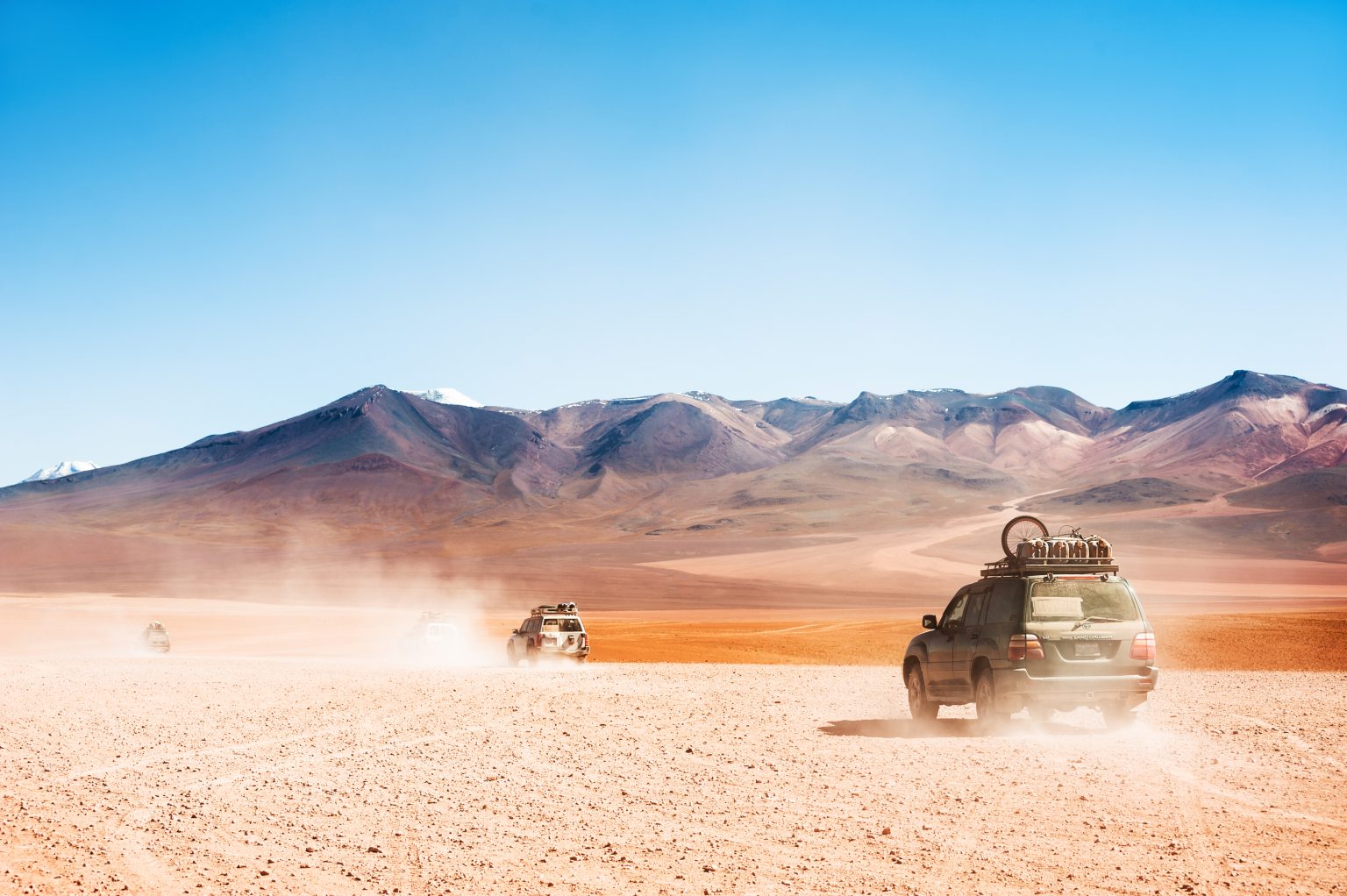
The Bolivian Altiplano is one of the world’s most distinctive high-altitude desert regions. Located between the eastern and western ranges of the Andes, this vast plateau combines salt flats, volcanic landscapes, mineral-rich lagoons, grasslands, and high mountain valleys.
- Where Is the Bolivian Altiplano Located?
- A High-Desert Landscape Forged by Fire and Time
- Altitude and Climate on the Altiplano
- Main Gateways to the Bolivian Altiplano
- Natural Wonders of the Altiplano Plateau
- Volcanoes, Hot Springs, and Extreme Landscapes
- Wildlife of Bolivia’s High Desert
- History and Living Culture of the Altiplano
- A Two-Day Bolivian Altiplano Itinerary
- Where to Stay on the Altiplano
- Practical Travel Tips
- Hidden Gems of the Altiplano
- Exploring Bolivia’s High-Altitude Desert
Much of the Altiplano lies between 3,600 and 4,800 meters above sea level, creating a cold and dry environment where altitude strongly influences the climate, wildlife, vegetation, and daily life of local communities.
The region is also home to some of Bolivia’s best-known natural attractions, including Salar de Uyuni, Laguna Colorada, Laguna Verde, Sajama National Park, and the Eduardo Avaroa Andean Fauna Reserve. Together, these landscapes make the Bolivian Altiplano one of South America’s most remarkable high-desert destinations.
Where Is the Bolivian Altiplano Located?
The Altiplano Plateau is the second-largest high plateau on Earth after Tibet. It extends across Bolivia, southern Peru, northern Chile, and northwestern Argentina.
In Bolivia, the Altiplano stretches from Lake Titicaca in the north to the Eduardo Avaroa Andean Fauna Reserve in the south, covering more than 70,000 square kilometers of desert plains, volcanoes, salt flats, and high-altitude lakes.
Geographically, it lies roughly between 15°S and 22°S, forming an important part of Bolivia’s geography and influencing the history, agriculture, transportation, and traditions of communities living across the plateau.
A High-Desert Landscape Forged by Fire and Time
The Altiplano was formed through millions of years of tectonic activity that lifted the Andes and shaped a high basin between the mountain ranges.
Ancient lakes and other water bodies once covered parts of the region. As these waters disappeared, they left behind salt flats, mineral deposits, volcanic formations, and high-altitude basins.
Volcanic activity continues to influence the landscape, while erosion has shaped rock formations and valleys across the plateau. The result is a varied environment where salt, volcanic rock, mountains, grasslands, and lagoons occur within the same high-altitude region.
Altitude and Climate on the Altiplano
The climate of the Bolivian Altiplano is strongly influenced by elevation and seasonal rainfall.
- Dry season: April to October
- Wet season: November to March
- Typical daytime temperatures: around 15°C
- Wet-season temperatures: generally below 18°C
- Winter nights: often below freezing
- Best conditions for clear views: generally during the dry season
From April to October, clear skies and dry conditions make many areas easier to explore, although nights can be extremely cold.
From November to March, occasional rainfall can create reflective surfaces on salt flats and around lagoons. Weather can change quickly at high elevations, so travelers should be prepared for both cold and strong sunlight.
Main Gateways to the Bolivian Altiplano
La Paz is the main gateway to the northern Altiplano, providing access to:
- Lake Titicaca
- Tiwanaku
- Sajama National Park
Uyuni is the principal starting point for many journeys through the southern Altiplano, providing access to:
- Salar de Uyuni
- Siloli Desert
- Eduardo Avaroa Andean Fauna Reserve
Travel across the plateau typically involves 4×4 vehicles, long-distance buses, or domestic flights, depending on the destination, season, and itinerary.
Natural Wonders of the Altiplano Plateau
At the heart of the southern plateau lies Salar de Uyuni, the largest salt flat in the world. Its immense white surface can appear almost completely flat and, during periods of shallow water, can create strong reflections of the sky.
The southern Altiplano is also known for several high-altitude lagoons:
- Laguna Colorada: reddish water associated with minerals and large flamingo populations
- Laguna Verde: greenish water beneath the Licancabur volcano
- Laguna Blanca: a pale, mineral-rich lagoon
- Laguna Hedionda: a high-altitude lagoon known for birdlife
In the north, Sajama National Park protects Bolivia’s highest peak, Nevado Sajama (6,542 m), together with volcanic landscapes, queñua forests, and natural hot springs.
Further south, Valle de las Rocas contains large volcanic rock formations shaped by long-term erosion.
Volcanoes, Hot Springs, and Extreme Landscapes
Volcanoes form some of the most recognizable landmarks across the Altiplano.
Major volcanic peaks and formations include:
- Licancabur
- Ollagüe
- Uturuncu
- Parinacota
Geothermal activity in several parts of the plateau also produces hot springs, allowing visitors to bathe in naturally heated water while surrounded by high-altitude desert landscapes.
Wildlife of Bolivia’s High Desert
Despite the extreme elevation and limited vegetation, the Altiplano supports a variety of wildlife.
- Llamas: widely associated with high-altitude pastoral communities
- Vicuñas: adapted to cold, dry grasslands
- Andean flamingos: gather around mineral-rich lagoons
- Andean condors: can be seen over mountain and volcanic landscapes
- Vizcachas: often found around rocky areas
The survival of these species depends on their ability to cope with low temperatures, intense solar radiation, limited water, and sparse vegetation.
History and Living Culture of the Altiplano
The Altiplano has been inhabited for thousands of years. The Tiwanaku civilization developed near Lake Titicaca and flourished between approximately 500 and 900 CE, leaving behind important ceremonial and architectural sites.
Today, Aymara and Quechua communities continue to live across parts of the plateau.
Important aspects of local culture include:
- Pachamama traditions and offerings
- Textile weaving
- Traditional music
- Seasonal festivals
- High-altitude pastoralism
Many communities maintain strong cultural relationships with mountains, lakes, and other elements of the natural environment.
A Two-Day Bolivian Altiplano Itinerary
Day 1
Depart from La Paz to explore Lake Titicaca and the Tiwanaku ruins, then continue toward Sajama National Park. End the day at a natural hot spring before spending the night in the area.
Day 2
Travel south toward Valle de las Rocas and Uyuni, stopping at selected high-altitude lagoons and flamingo habitats along the route. Finish the day near Salar de Uyuni.
Because of the distances involved, a complete La Paz-to-Uyuni route covering these locations generally requires more than two days. This itinerary works better as an overview of the main landscapes rather than a practical door-to-door schedule.
Where to Stay on the Altiplano
Accommodation is generally simple and adapted to the remote environment.
- Ecolodge Sajama: accommodation near Sajama National Park and Bolivia’s highest peak
- Tayka lodge network: eco-oriented accommodation across parts of the southern Altiplano
- Community homestays: opportunities to stay with local Aymara families and learn about high-altitude rural life
Travelers should expect limited services in remote areas and prepare for cold nights regardless of the season.
Practical Travel Tips
- Acclimatization: spend time at altitude before visiting the highest areas
- Sun protection: bring sunscreen, sunglasses, and a hat
- Clothing: use layers for changing temperatures
- Hydration: drink plenty of water and avoid rushing during the first days
- Connectivity: download offline maps because mobile coverage is limited
- Cultural respect: ask permission before photographing people or sacred sites
- Transportation: use experienced drivers or organized 4×4 tours for remote routes
Hidden Gems of the Altiplano
- Laguna Celeste: a remote blue-toned lagoon near the Chilean border
- Quetena Grande: a small community offering access to local homestays and southern Altiplano routes
- Coipasa Salt Flat: a quieter alternative to the more famous Salar de Uyuni
- Chacaltaya: a former high-altitude ski area near La Paz associated with the region’s changing glaciers
- Uyuni Train Cemetery: preserved railway equipment reflecting Bolivia’s mining and transportation history
Exploring Bolivia’s High-Altitude Desert
The Bolivian Altiplano is defined by its combination of extreme altitude, volcanic mountains, salt flats, mineral-rich lagoons, wildlife, and long-established communities.
A journey across the region can connect La Paz and Lake Titicaca with Sajama National Park, Salar de Uyuni, the colorful lagoons, Valle de las Rocas, Siloli, and the Eduardo Avaroa Reserve.
For travelers exploring Bolivia’s desert landscapes, the Altiplano offers an experience shaped less by traditional sand dunes and more by altitude, volcanic geology, salt, cold, and dramatic changes in elevation. Its landscapes also show how people and wildlife have adapted to one of the highest desert environments in South America.