
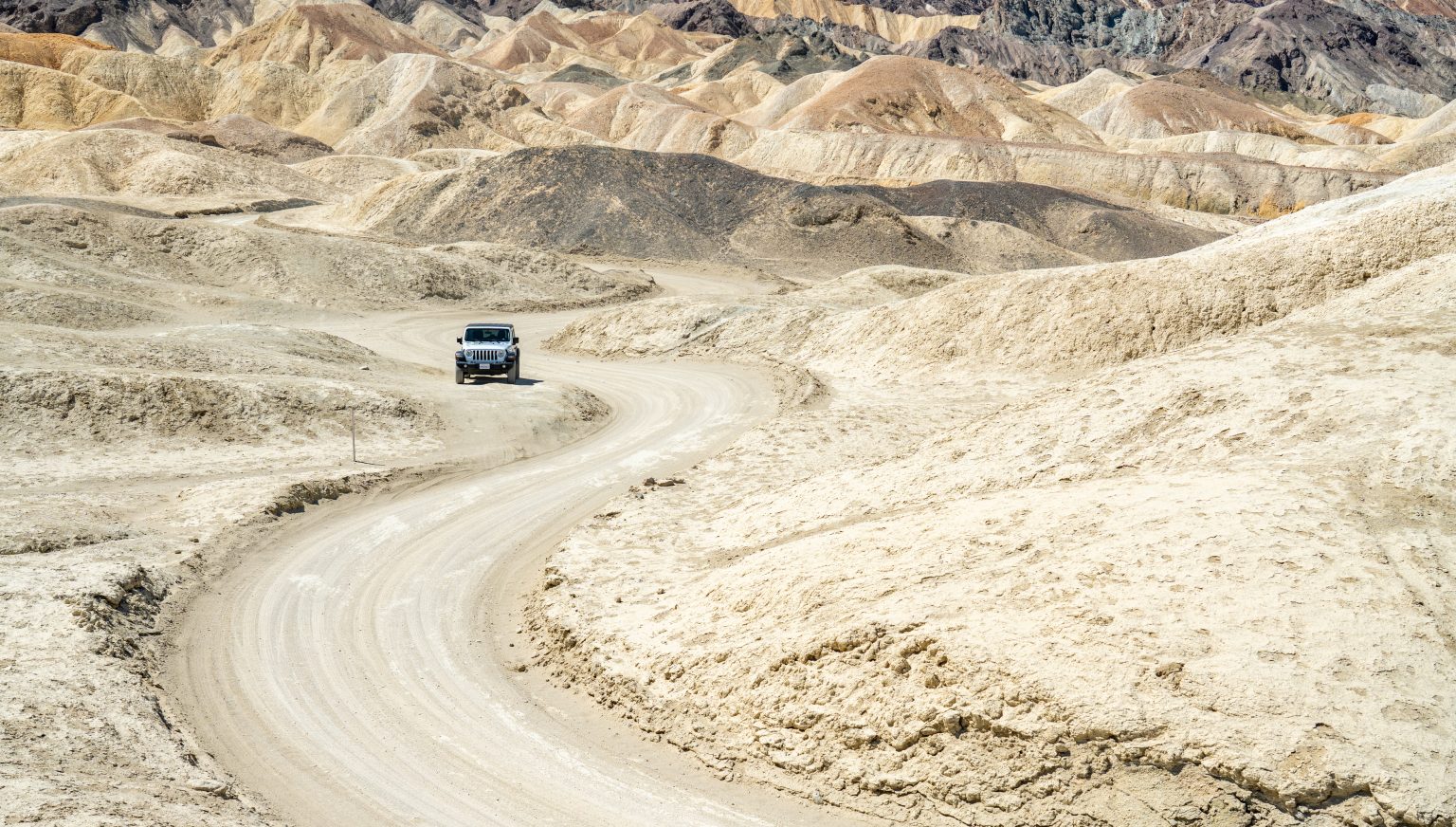
The Mojave Desert in California offers rugged mountain ranges, volcanic formations, vast sand dunes, and remote tracks that appeal to outdoor enthusiasts. From historic off-road routes to scenic hiking trails, Mojave Desert adventures combine exploration with the practical challenges of traveling through a dry, sparsely populated landscape. This guide covers the main Mojave Desert 4×4 routes, hiking areas, camping options, and safety essentials to help you plan a responsible visit.
- Exploring the Mojave Desert
- Best 4×4 Routes in the Mojave Desert
- Top Hiking Trails in the Mojave Desert
- Best Time to Visit the Mojave Desert
- Preparing for a Mojave Adventure
- Camping in the Mojave Desert
- Safety and Responsible Desert Travel
- A Suggested Three-Day Mojave Itinerary
- Day 1: Afton Canyon and the Mojave River
- Day 2: Kelso Dunes and Hole-in-the-Wall
- Day 3: Teutonia Peak and the Cima Dome area
- Experience the Mojave Beyond the Road
Exploring the Mojave Desert
The Mojave Desert covers roughly 47,000 square miles (about 120,000 km²), mainly in southeastern California, with smaller sections extending into Nevada, Utah, and Arizona. Its landscapes include broad basins, rugged mountain ranges, volcanic fields, Joshua tree woodlands, and shifting dunes. Death Valley lies within the wider Mojave Desert region, while Joshua Tree National Park protects parts of both the Mojave and Colorado deserts.
Key facts about the region include:
- Elevation: The landscape ranges from below sea level in Death Valley to mountain peaks above 2,000 meters.
- Climate: Conditions are generally dry, with substantial temperature differences between seasons, elevations, and day and night.
- Vegetation: Creosote bushes, Joshua trees, cacti, and other drought-adapted plants grow in different parts of the desert.
- Geology: Volcanic formations, lava tubes, rocky canyons, sand dunes, and dry lakebeds reflect a complex geological history.
- Cultural heritage: The Mojave people have longstanding connections to the region. Indigenous communities and other residents have shaped its history over generations.
Distances between attractions can be considerable, and services are limited in remote areas. Planning fuel stops, checking road conditions, and carrying enough water are essential parts of any trip.
Best 4×4 Routes in the Mojave Desert
Mojave Road
The Mojave Road is a historic off-road route crossing Mojave National Preserve between the Colorado River region and the western Mojave near Barstow. Indigenous people used routes through this landscape long before European-American travelers arrived, and the corridor later became associated with explorers, emigrants, and military travel.
Highlights along the route include:
- Remote desert basins, rocky terrain, and broad open landscapes.
- Historic sites such as Rock Spring, an important water source for earlier travelers.
- Sections of Mojave National Preserve with volcanic formations and wide views of the surrounding mountains.
- Opportunities to experience the scale and isolation of the desert away from major highways.
This is a demanding backcountry drive, not a maintained tourist road. A high-clearance 4×4 with low-range gearing and suitable tires is strongly recommended. Carry recovery equipment, extra fuel, food, and sufficient water for everyone in the vehicle. Bring offline navigation and a paper map, and check the latest road conditions before departure.
The cooler months, generally from autumn through spring, are usually more suitable for this journey. Allow enough time to travel slowly and deal with unexpected obstacles rather than treating the route as a race from one end to the other.
Afton Canyon
Afton Canyon is a distinctive section of the Mojave River where the watercourse cuts through steep, colorful canyon walls. Located near Interstate 15 in the eastern Mojave, it offers a different landscape from the region’s open dunes and rocky basins.
Reasons to visit include:
- Scenic canyon walls and views along the Mojave River.
- Opportunities for photography, birdwatching, and observing desert wildlife.
- Nearby camping opportunities where permitted.
- A chance to explore a river corridor in an otherwise arid landscape.
Water levels and road conditions vary. Do not assume that river crossings will be shallow or safe, and avoid entering washes or low-lying areas when storms threaten. Wildlife sightings, including bighorn sheep, are never guaranteed, so observe animals from a respectful distance.
Before driving into the canyon, confirm current access and camping rules with the relevant land manager. Some tracks may be rough or affected by flooding, even when the main access road is open.
Death Valley Backcountry Roads
Death Valley National Park contains dramatic desert scenery, from salt flats and colorful badlands to narrow canyons and remote mountain roads. Several backcountry routes are popular with experienced drivers, but their condition and accessibility can change after flash floods and other weather events.
Routes to research include:
- Titus Canyon Road: A historic one-way route known for narrow canyon walls, mining history, and rugged desert scenery. Check current closures carefully before planning a drive.
- Echo Canyon Road: A rough route through rocky terrain that requires careful assessment of vehicle suitability and current conditions.
- Racetrack Valley Road: The access route to the Racetrack Playa, famous for its moving-stone tracks. The journey is long and rough, and high-clearance vehicles with appropriate tires are advisable.
Do not assume that a road is open simply because it appears on a navigation app. Consult the National Park Service’s current road-status information, carry recovery supplies, and avoid backcountry routes when rain or flash-flood conditions are forecast. Some drives require substantial time and should not be squeezed into a short stop.
Top Hiking Trails in the Mojave Desert
Kelso Dunes Trail
Kelso Dunes, located in Mojave National Preserve, rise above the surrounding desert floor and are known for a sound sometimes produced by moving sand. The dunes are a popular destination for visitors who want expansive views without technical climbing equipment.
Trail details:
- Distance: Approximately 3 miles (4.8 km) round trip, depending on the route taken across the dunes.
- Difficulty: Moderate to strenuous because walking on loose sand requires considerable effort.
- Terrain: Open sand slopes with little shade.
- Best conditions: Cooler mornings or late afternoons during autumn, winter, and spring.
The summit offers broad views across the surrounding desert. The sound of singing sand is a natural phenomenon that depends on the condition and movement of the grains, so it may not occur during every visit.
Carry plenty of water, protect yourself from the sun, and allow extra time for the return journey. The dunes can be exhausting in hot weather, even when the distance appears short on a map.
Hole-in-the-Wall Rings Loop Trail
The Rings Loop Trail near Hole-in-the-Wall Campground explores volcanic rock formations and a narrow canyon within Mojave National Preserve. Metal rings installed in sections of Banshee Canyon help hikers negotiate steep rock passages.
What to expect:
- A roughly 1.5-mile (2.4 km) round-trip route.
- Rock corridors, unusual volcanic formations, and views of the surrounding landscape.
- Short, steep sections where hikers use the metal rings for assistance.
- A moderate hike that requires sure footing and comfort with scrambling.
Although the trail is relatively short, the ring-assisted sections are not suitable for everyone. Check trail conditions before setting out, wear shoes with good grip, and do not attempt the route if you are uncomfortable climbing through narrow rock passages. Children should be supervised closely.
Teutonia Peak Trail at Cima Dome
The Teutonia Peak Trail crosses a landscape shaped by Joshua trees, rocky slopes, and open views across the Cima Dome area. The trail is especially interesting for visitors who want to explore the Mojave’s distinctive vegetation as well as its geology.
Trail highlights include:
- Distance: About 3 miles (4.8 km) round trip.
- Difficulty: Moderate, with uneven ground and a rocky climb near the peak.
- Scenery: Joshua trees, desert mountain views, and the broad landscape of Cima Dome.
- Seasonal interest: Spring flowers may appear when rainfall and temperatures are favorable.
The area was affected by a major wildfire in 2020, so visitors should expect a landscape that includes both surviving trees and burned woodland. Follow current trail guidance, stay on established paths, and avoid damaging recovering vegetation.
Best Time to Visit the Mojave Desert
Autumn, winter, and spring generally offer the most comfortable conditions for hiking and backcountry travel. However, temperatures vary substantially between low desert basins and higher elevations, so check forecasts for each part of your itinerary.
- October to November: Cooler days often make hiking and off-road exploration more comfortable, although conditions can still be hot.
- December to February: Daytime weather may be suitable for outdoor activities, but nights can be very cold, especially at higher elevations.
- March to April: Spring can bring wildflowers in favorable years, along with changing temperatures and occasional strong winds.
- May to September: Extreme heat is possible, particularly at lower elevations. Hiking and strenuous driving should be planned with great care, and some activities may be unsafe during the hottest periods.
For many visitors, November through March offers a useful balance of daytime temperatures and opportunities for outdoor exploration. There is no universally ideal month, however. Check forecasts, road reports, and any park alerts shortly before departure.
Preparing for a Mojave Adventure
Remote desert travel requires more preparation than a drive through a developed area. Mobile coverage can be unreliable or absent, and assistance may be far away.
Essential equipment
- A suitable vehicle for the planned route, with a well-maintained spare tire and the tools needed to change it.
- Extra fuel when traveling on routes with no nearby service stations.
- Offline GPS navigation, a paper map, and a compass as a backup.
- Ample drinking water for every person, plus extra reserves for delays.
- Food and snacks that can withstand warm conditions.
- A first-aid kit, sunscreen, sunglasses, and protective clothing.
- Sturdy footwear for hiking over loose sand and rough rock.
- A flashlight or headlamp, emergency blanket, and reliable communication equipment suitable for remote travel.
For extended backcountry trips, consider a satellite messenger or satellite phone and make sure you understand how to use it before leaving.
Before leaving
- Check official road conditions and closures for every route on your itinerary.
- Tell someone where you are going and when you expect to return.
- Download maps and important information before entering areas without mobile coverage.
- Confirm fuel availability, camping rules, and access restrictions.
- Avoid traveling alone on difficult routes unless you have the experience and equipment to manage a breakdown.
- Never drive across an unmarked wash or dry lakebed simply because it looks passable.
Water needs depend on heat, exertion, health, and the length of the trip. Carry substantially more than you expect to drink during a short outing, and do not rely on finding natural water sources along the way.
Camping in the Mojave Desert
Camping allows visitors to experience the desert after day visitors have left and the sky becomes darker. Choose an established campground or a location where overnight stays are explicitly permitted.
Options to consider include:
- Hole-in-the-Wall Campground: A developed campground in Mojave National Preserve, close to the Rings Loop Trail and surrounding volcanic scenery.
- Afton Canyon: An option for travelers exploring the Mojave River corridor, subject to current access and camping rules.
- Mesquite Spring Campground: A developed campground in Death Valley National Park, useful for exploring the park’s northern section.
These locations are in different parts of the wider desert region, so they should not be treated as neighboring stops. Check driving distances before combining them in one itinerary.
For a comfortable and responsible camping trip:
- Bring warm layers for cold nights, even after a hot day.
- Use designated fire facilities only when fires are permitted, and follow current restrictions.
- Pack out all rubbish and leave rocks, plants, and historic objects undisturbed.
- Keep food secured and never feed wildlife.
- Check campground availability and access conditions before departure.
Clear desert skies can offer excellent stargazing, but visibility depends on cloud cover, moonlight, haze, and other local conditions.
Safety and Responsible Desert Travel
The Mojave’s beauty can disguise its practical challenges. Heat, dehydration, rough roads, sudden storms, and long distances between services all deserve serious attention.
Follow these precautions:
- Respect the heat: Avoid strenuous activity during the hottest part of the day and turn back if conditions become unsafe.
- Prepare for cold nights: Pack suitable insulation when camping or traveling at higher elevations.
- Watch the weather: Flash floods can occur in canyons and washes, including areas where it is not raining directly overhead.
- Stay on established routes: Driving off designated roads can damage fragile desert habitats and may violate land-management rules.
- Protect wildlife: Give snakes, tortoises, and other animals space. Never handle wildlife unless specifically instructed by qualified authorities in an emergency.
- Preserve cultural sites: Do not touch, remove, or deface rock art, archaeological objects, or historic structures.
- Plan for communication gaps: Do not assume that a mobile phone will work in remote areas.
Always check official alerts before entering a national park or preserve. Conditions can change after storms, and a route that was open during a previous visit may be closed or unsuitable today.
A Suggested Three-Day Mojave Itinerary
This itinerary focuses on the eastern Mojave and Mojave National Preserve. It is a starting point rather than a fixed schedule, since driving times depend on road conditions, vehicle capability, and the time spent at each stop.
Day 1: Afton Canyon and the Mojave River
Arrive in the Afton Canyon area and explore the river corridor where access is open and safe. Spend time photographing the canyon landscape, watching for birds, and enjoying the contrast between water and dry terrain. Camp at an approved site after checking current rules and conditions.
Day 2: Kelso Dunes and Hole-in-the-Wall
Travel toward Mojave National Preserve and hike the Kelso Dunes during the cooler part of the day. Allow enough time for the demanding walk through loose sand. Later, continue toward Hole-in-the-Wall, explore the surrounding volcanic landscape, and hike the Rings Loop Trail if conditions and your abilities permit.
Choose a suitable campground for the night and verify road conditions before driving between the two areas.
Day 3: Teutonia Peak and the Cima Dome area
Start early for the Teutonia Peak Trail. Take time to observe the Joshua trees and the effects of the 2020 wildfire, and enjoy views across the Cima Dome landscape. After the hike, return via an appropriate paved route, allowing time for fuel and rest stops.
Planning note: Death Valley and Joshua Tree National Park are separate destinations that require additional driving time. If either is a priority, plan a separate trip or add extra days rather than trying to fit every attraction into this three-day route.
Experience the Mojave Beyond the Road
The Mojave Desert rewards travelers who balance curiosity with preparation. Historic tracks, volcanic canyons, high dunes, and Joshua tree landscapes reveal different sides of this vast region, but each requires respect for its conditions and natural limits.
Whether you choose a challenging Mojave Road 4×4 journey, a hike across Kelso Dunes, or a quiet night at an established campground, plan around the weather, confirm access before you leave, and give yourself time to explore without rushing. The best desert experiences come from understanding the landscape, traveling responsibly, and leaving its fragile places as you found them.