
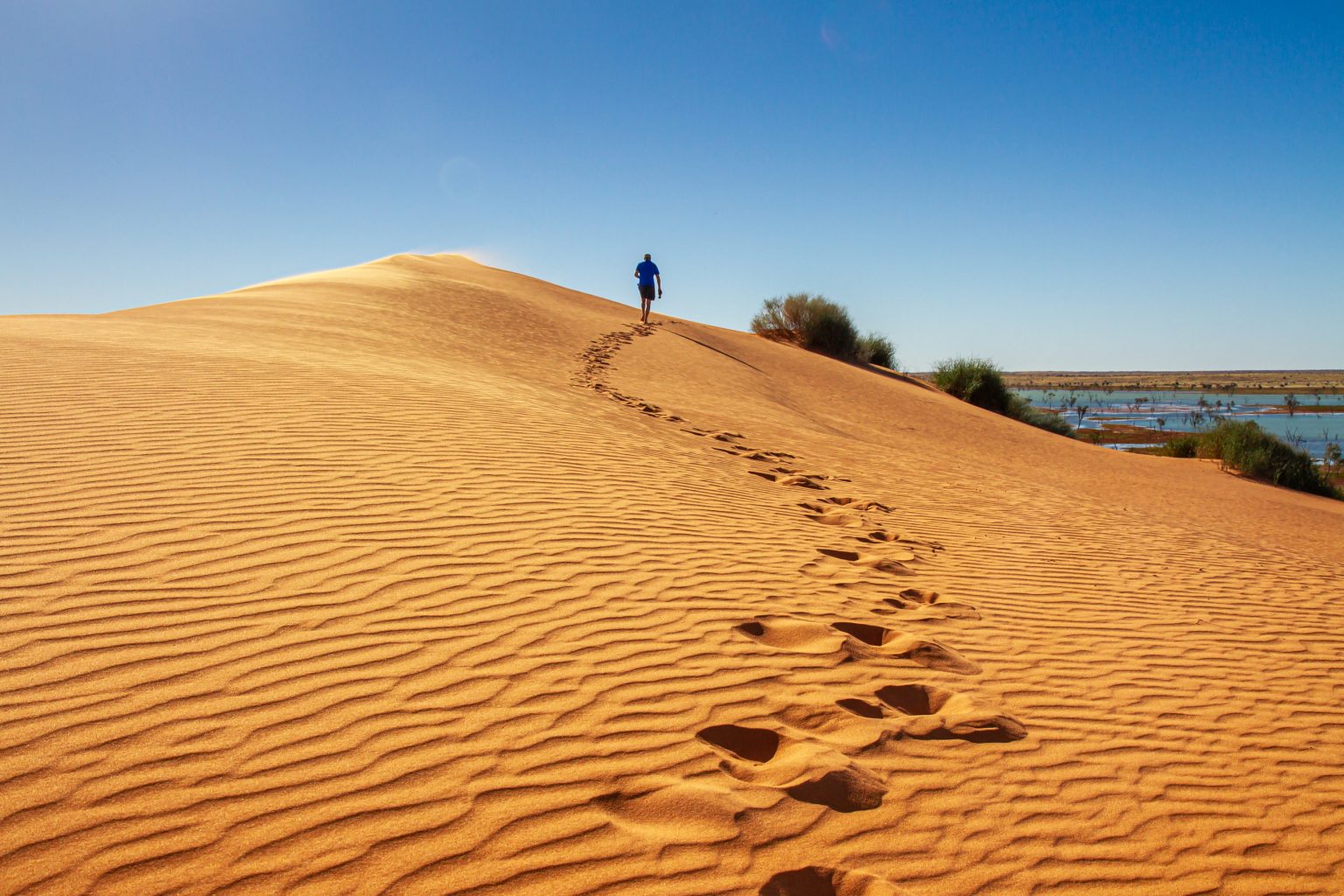
At the heart of Australia lies the Simpson Desert, a vast and remote landscape of red sand dunes, salt flats, clay pans, seasonal waterholes, and desert vegetation. Stretching across Queensland, South Australia, and the Northern Territory, it is one of Australia’s largest deserts and one of the country’s most isolated environments.
- Where Is the Simpson Desert Located?
- The Landscape of the Simpson Desert
- Climate and Weather in the Simpson Desert
- Plant Life of the Simpson Desert
- Wildlife of Australia’s Red Desert
- Aboriginal Heritage and Dreamtime of the Simpson Desert
- Key Places to Visit in the Simpson Desert
- Big Red
- Poeppel Corner
- Dalhousie Springs
- French Line, QAA Line, and Rig Road
- Mac Clarke Conservation Reserve
- Two-Day Simpson Desert Itinerary
- Where to Stay in the Simpson Desert
- Practical Travel Tips for the Simpson Desert
- Hidden Places in the Simpson Desert
- Exploring Australia’s Red-Dune Wilderness
The desert is best known for its long parallel dunes, extreme temperatures, limited rainfall, and demanding 4WD crossings. It also supports a highly adapted ecosystem and has deep cultural significance for Aboriginal communities whose connections to the region extend back thousands of years.
For travelers, the Simpson Desert offers a challenging outback experience shaped by its enormous scale, changing weather, distinctive wildlife, and extensive dune country.
Where Is the Simpson Desert Located?
The Simpson Desert covers approximately 176,500 square kilometers (68,100 square miles) across the Northern Territory, Queensland, and South Australia.
Its approximate position is near 24°S, 137°E, with elevations generally ranging from about 50 to 300 meters above sea level.
The desert is bordered by the MacDonnell Ranges to the northwest, the Lake Eyre Basin to the south, and the Channel Country to the east. Several waterways reach the margins of the desert, but permanent surface water is extremely limited.
Groundwater is an important part of the wider desert environment, particularly around springs associated with the Great Artesian Basin.
The Landscape of the Simpson Desert
The Simpson Desert is famous for its long, parallel sand dunes, which generally run from north to south. The region contains one of the world’s largest areas of parallel linear dunes, with some dune systems extending for very long distances across the desert.
Big Red, also known as Nappanerica Dune, rises to around 40 meters and is one of the most recognizable dunes in the region. Located near Birdsville, it is a popular starting point for visitors entering the desert.
Between the dunes are:
- Salt flats
- Clay pans
- Seasonal waterholes
- Sparse vegetation
- Broad sandy plains
Iron-rich minerals contribute to the characteristic red and orange colors of the sand, particularly noticeable around sunrise and sunset.
Climate and Weather in the Simpson Desert
The Simpson Desert experiences some of Australia’s most demanding desert conditions. Rainfall is highly variable and generally low, while summer temperatures can become extreme.
- Annual rainfall: typically less than 150 mm
- Summer temperatures: can exceed 50°C (122°F)
- Winter nights: can fall to around 5°C (41°F)
- Best travel period: generally May to September
The cooler months are much more suitable for long-distance 4WD travel and camping.
Rainfall can occasionally transform parts of the desert. Temporary lakes and waterholes fill, vegetation responds quickly, wildflowers may appear, and frogs emerge from dormant states. Bird numbers can also increase around temporary water sources.
Plant Life of the Simpson Desert
Despite its dry appearance, the Simpson Desert supports vegetation adapted to sandy soils, limited rainfall, and extreme temperatures.
- Spinifex grasses dominate many dunes and help stabilize the sand.
- Desert oak trees occur in parts of the desert, particularly where conditions support deeper-rooted vegetation.
- Mulga grows in suitable areas and responds to rainfall with new foliage.
- Wildflowers can appear after significant rainfall, although flowering displays vary greatly from year to year.
The amount of vegetation visible during a visit depends heavily on recent rainfall and local conditions.
Wildlife of Australia’s Red Desert
The Simpson Desert supports a range of mammals, reptiles, birds, and amphibians adapted to an arid environment.
- Red kangaroos move across the open desert and surrounding plains.
- Dingoes range across large territories in search of food and water.
- Bilbies and other small desert mammals are primarily nocturnal.
- Thorny devils, geckos, and bearded dragons are among the reptiles found in the wider region.
- Emus and wedge-tailed eagles can be seen in suitable areas.
- Budgerigars and other birds may become more numerous around temporary water after rainfall.
- Desert frogs can emerge following substantial rain and may remain dormant for long periods between favorable conditions.
Many desert animals avoid the hottest part of the day, making early morning and evening the most productive times for wildlife observation.
Aboriginal Heritage and Dreamtime of the Simpson Desert
The Simpson Desert has deep cultural significance for Aboriginal Australians, including the Wangkangurru, Arrernte, and Yarluyandi peoples.
Aboriginal connections with the region extend back thousands of years. Knowledge of water sources, seasonal conditions, plants, animals, and travel routes has been passed between generations through cultural traditions that include stories, songlines, and other forms of knowledge.
For Aboriginal communities, the desert is a cultural landscape rather than an empty wilderness. Visitors should respect culturally significant areas, follow access rules, and avoid disturbing archaeological or cultural sites.
Key Places to Visit in the Simpson Desert
Big Red
Located near Birdsville, Big Red is one of the best-known dunes in the Simpson Desert and a popular starting point for desert excursions and photography.
Poeppel Corner
Poeppel Corner marks the point where Queensland, South Australia, and the Northern Territory meet. The site is named after surveyor Augustus Poeppel and is an important landmark for travelers crossing the desert.
Dalhousie Springs
Dalhousie Springs is part of the Great Artesian Basin and provides a striking contrast to the surrounding dry landscape. Its warm waters make it a popular stopping point for travelers following desert routes.
French Line, QAA Line, and Rig Road
These established 4WD routes cross sections of the Simpson Desert and are used by experienced outback travelers. Conditions can change quickly, and route planning is essential.
Mac Clarke Conservation Reserve
The Mac Clarke Conservation Reserve protects Acacia peuce, a rare desert tree species with a very restricted natural distribution.
Two-Day Simpson Desert Itinerary
Day 1
Begin in Birdsville and visit Big Red before continuing along an established 4WD route such as the QAA Line. Camp in the desert at an approved location and prepare for a cold night if traveling during the cooler months.
Day 2
Continue toward Poeppel Corner and explore nearby desert and salt-pan landscapes. Depending on the route and road conditions, continue toward Dalhousie Springs before returning or traveling onward toward Alice Springs.
A two-day schedule is highly condensed for such a large and remote region. Longer crossings are generally more practical for travelers who want to explore the desert beyond the main landmarks.
Where to Stay in the Simpson Desert
Birdsville
Birdsville provides accommodation, supplies, fuel, and services before entering the desert. The Birdsville Hotel is one of the town’s best-known outback establishments.
Mount Dare
Mount Dare provides fuel, camping, and basic services for travelers approaching the desert from the west and south.
Dalhousie Springs
Camping near Dalhousie Springs allows travelers to stay within the desert environment while remaining close to one of the region’s major natural water sources.
Because services are extremely limited once travelers enter remote areas, supplies and accommodation should be planned before departure.
Practical Travel Tips for the Simpson Desert
The main travel season is generally May to September, when temperatures are more manageable.
Important preparation includes:
- 4WD vehicle: essential for crossing the major dune routes
- Water: carry a substantial reserve because reliable supplies are limited
- Fuel: carry enough for the planned route with an additional reserve
- Communication: satellite communication is strongly recommended
- Recovery equipment: essential for sand travel and vehicle recovery
- Permits: check the requirements for the areas and routes included in your trip
- Travel companions: traveling with another vehicle is strongly recommended in remote sections
- Weather checks: heavy rain can affect roads and desert tracks
Conditions can change rapidly, so travelers should check route information before departure and be prepared to change plans.
Hidden Places in the Simpson Desert
Several less-visited locations and landscapes can add depth to a Simpson Desert journey:
- Approdinna Attora Knolls, known for their gypsum-rich hills and wide desert views
- Eyres Creek, which can carry water after significant rainfall
- Old Andado Station, associated with the history of early outback settlement
- Remote dune tracks and desert plains, accessible only through properly planned 4WD journeys
These areas require careful planning because distances are large and services are scarce.
Exploring Australia’s Red-Dune Wilderness
The Simpson Desert is defined by its scale and environmental extremes. Its long red dunes dominate the landscape, while salt pans, seasonal water sources, hardy vegetation, and desert wildlife occupy the spaces between them.
The same environment also carries a much older cultural history. Aboriginal communities maintain longstanding connections to the land, while modern 4WD routes allow experienced travelers to cross parts of this vast desert under carefully managed conditions.
For visitors prepared for its remoteness, the Simpson Desert offers a direct experience of Australia’s red-dune country, desert ecology, and Aboriginal cultural landscape, with the scale and conditions of the environment shaping every stage of the journey.